Published by Jeremy. Last Updated on July 16, 2025.
Disclaimer: Our site uses demographic data, email opt-ins, display advertising, and affiliate links. Please check out our Terms and Conditions. Pricing, operating hours, or menus may have changed since our initial visit and may not be reflected in subsequent updates. Please confirm these directly with any business or attraction prior to visiting.
When we visit cities around the world as travelers, one of the first things we do is figure out a grand walking tour in order to get a feel for the city. We generally take anywhere from a half-day or full-day to do these self-guided city tours and really love checking things out on foot.
Until now, we had never put together one of these guides for Pittsburgh as our 90 neighborhoods often make it difficult to get around and see them all. Still, the neighborhoods in and around the central business district in downtown Pittsburgh have quite a lot to see and many of these spots are on the radar of those visiting Pittsburgh for the first time as well as long-time residents.
So in this one, we wanted to share what we consider to be the ultimate walking tour of downtown Pittsburgh! This walking tour covers five miles in the North Side, downtown Pittsburgh, Mount Washington, and Station Square and has 17 unique highlights worth checking out.
So put your walking shoes on and get to exploring this beautiful city!
🗺️ Planning a Trip to Pittsburgh?
Book your trip early to snag a deal and have a great time!
🏨 Top-Rated Hotels in Pittsburgh
- Great Value: Drury Plaza offers excellent prices downtown.
- Good Views: Sheraton Station Square features stellar views from river-view rooms.
- Free Parking: Hampton Inn Strip District includes free parking and a great location.
🏡 Looking for an apartment rental? Find a deal on Airbnb!
🚌 Book a Day Tour
- Hop On, Hop Off Tours: A double-decker bus tour around the city with 20+ stops. Also available as Just the Tour for a ride around the city.
- Downtown Pittsburgh Walking Tour: Take a guided walking tour of downtown.
- Downtown Food Tour: Explore downtown while enjoying many food stops.
Upfront Notes About This Pittsburgh Walking Tour
We have personally walked this route from start to finish and completed the five-mile walk in about 2.5 hours. We walked at a fairly brisk pace and only stopped for a quick snack (ten minutes). As we recognize that everyone walks at different speeds, and the inclines can often have lines, we think that most people would take a minimum of 3 hours to complete this walk. Use this as your starting point for time estimation. If you're the kind of walker who likes to stop and appreciate every sight in great detail, this route could take a fair bit longer.
After each major stop, we'll feature some additional detours for things you can see, places to eat, or stops to grab a drink at nearby. Note that you will have to estimate your own amount of time spent on any detour beyond our main stops, and there are many other interesting things we have not included you might spot along the way as well. You very much could use this guide to make a day out of all of the detour options if you wanted to hit a bunch- our main itinerary is just a starting point! Operating hours may vary.
It is also worth noting that the inclines also charge for each ride and require cash payment with exact change. No ATM is available on-site but the stations have bill changers to break bills which may or may not always be in working order. That being said, we recommend carrying exact change for your party. Current pricing for each incline can be found here and here.
This walk also includes a mix of stairs, bridge crossings, and a few narrow paths. As such, there may be some accessibility issues for non-walkers.
Finally, we've used a mix of photos from our exact walk and photos from previous walks around the city. So if you're curious why the lighting changes drastically, this is why. Sadly, our first walkabout on this itinerary was fairly overcast and we weren't particularly happy with the photos.
A Five-Mile Walking Tour of Pittsburgh Map
The map for our walking tour of Pittsburgh is illustrated above and available to use on Google Maps on your phone by clicking here.
If you need parking within close proximity to this route, Allegheny Commons (metered until 6pm and free on Sundays) and the garage at NOVA Place in the North Side often have spots (non-game days), the PPA operated garages downtown offer flat-rate night and weekend rates, and the parking garage at Station Square often has spots available as well (they charge hourly 24/7 with surge pricing during events). We do not recommend parking on Mount Washington as meters are limited (both in quantity and time-wise) and street parking is permit based.
As this walk is a loop, you can really start wherever you like and still get everything out of this itinerary. If you are short on time you can also cut sections out as well. We began at the Mr. Rogers Statue Tribute to Children in the North Side during our walk and have this guide structured based on that.
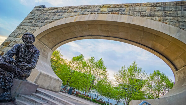
Mr. Rogers Statue – Tribute to Children
Fred Rogers is arguably the most well-known television personality to come out of Pittsburgh and he entertained millions upon millions of children with Mr. Rogers' Neighborhood which aired from 1968 to 2001.
Mr. Rogers was quite the humble guy and his wife was quoted saying that he would never have wanted a memorial to himself. Hence, this statue is entitled Tribute to Children. The statue of Mr. Rogers was built by artist Robert Berks (whose work we'll see later on in this tour), was commissioned in 2008 for what would've been Mr. Rogers' 80th birthday, and was installed in the former Manchester Bridge Pier.
When visiting this rather large statue, you'll likely hear one of 29 audio segments playing clips from Mr. Rogers' Neighborhood. We couldn't think of a better place to start our tour than here.
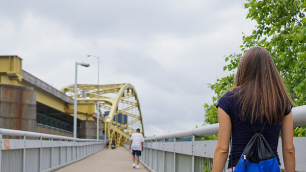
From there, we're going to walk east along the Three Rivers Heritage Trail (towards the city) and climb up the stairs to the walking path on the Fort Duquesne Bridge (the first bridge you see in front of you). The pathway here will be on your left side as you walk up to the bridge.
Optional Detour: Before heading to the Fort Duquesne Bridge, if you walk a bit further west along the river trail you'll see the Carnegie Science Center and behind it the USS Requin– our tench class submarine from World War II! This detour will add about ten minutes of walking in total.
The Fountain at Point State Park
After crossing the bridge, you'll find yourself in a tranquil garden within Point State Park. After entering the park turn immediately to your right and you'll find a set of steps that will take you down to the river trail that you likely saw when on the opposite side of the bridge.
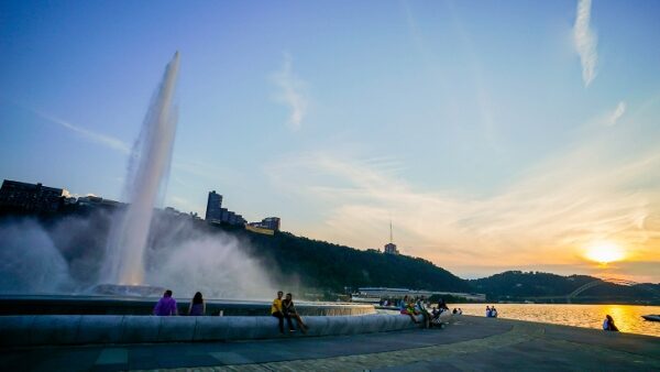
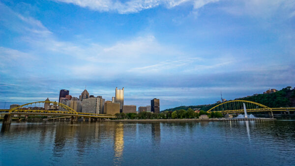
Turn left when on the trail and walk a few minutes where you'll arrive at the fountain at Point State Park (seasonal operation). This point marks the confluence of our three rivers- the Allegheny (north), Monongahela (south), and Ohio (west). This piece of land was home to former military outposts by the British and French due to its strategic location on the river.
If you head towards the city along the grassy path directly behind the fountain, you'll find outlines of the former Fort Duquesne as well as the Fort Pitt Blockhouse (but more on that one below). If it has rained recently, this grass may be quite muddy and otherwise you may want to just continue walking around the river trail until you reach the Fort Pitt Bridge (the bridge directly in front of you over the Monongahela River).
Here, walk up the path right below it (on your left) and head towards the Fort Pitt Blockhouse in front of you.
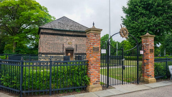
The Fort Pitt Blockhouse
The Fort Pitt Blockhouse was built in 1764 and is considered to be the oldest building in Pittsburgh (and any building west of the Allegheny Mountains). This structure was first used as a defensive outpost for the fort and then later as a trading post.
The blockhouse is free to enter when open and days of operation vary by season. After checking out the blockhouse, turn around and get on the walkway behind the Fort Pitt Museum just a few steps away (see photo below). This will take you across a narrow walking path on the Fort Pitt Bridge which will veer off onto West Carson Street and directly into the lower station of the Duquesne Incline- our next stop!
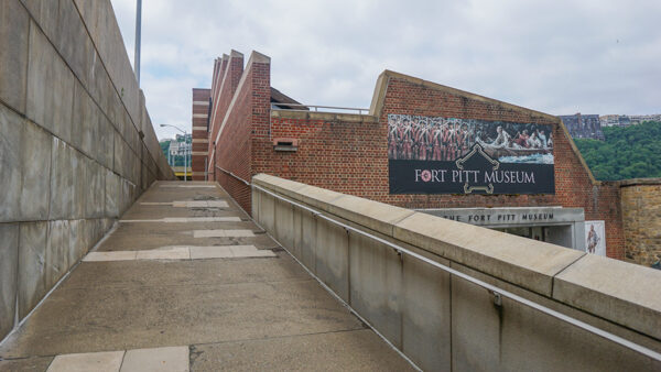
Optional Detour: The Fort Pitt Museum is a modest museum dedicated to the early history of Pittsburgh and gives more history of the fortifications, the battles over control of the confluence, and more. This detour will likely add on at least 30 minutes. If you do visit the Fort Pitt Museum, you can take your ticket to the Heinz History Center later in the day (or next day) to have that ticket fee applied to your cost of visiting that museum- a great perk! (This should be reconfirmed on the History Center's website prior to visiting.)
Want a shorter and/or free walking route? You can skip the inclines and Mount Washington segment of this walking tour here. Instead of taking the path across the Fort Pitt Bridge, head to the back side of the Fort Pitt Museum, down to the Monongahela River, and turn left on the river trail. This will put you on the GAP trail and connects up with the Smithfield Street Bridge which is a stop further down in the itinerary. This will cut off roughly one mile of walking and the fees for the inclines.
Duquesne Incline
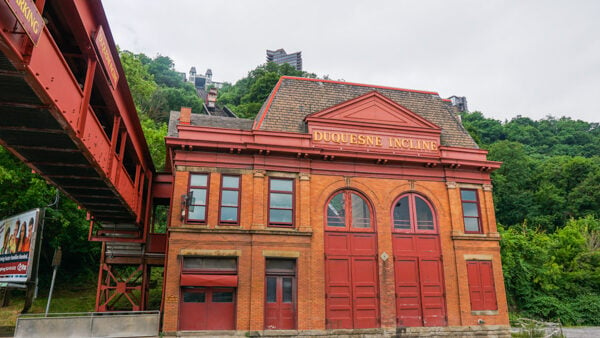
Prior to the invention of cars, many workers would ride funiculars up and down the hills around Pittsburgh. Over the years, many of these were removed, and today two remain.
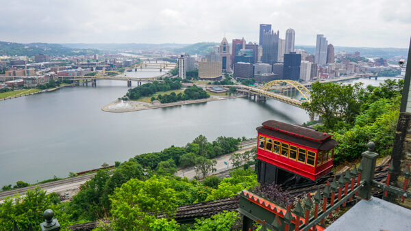
The Duquesne Incline (built in 1877) is often considered to be the most popular tourist attraction in Pittsburgh, and with good reason- it offers stellar views of the Pittsburgh skyline from the ride up and at the upper station's platform (down the hallway to your right as you exit)!
When here, be sure to stick around and check out all of the historic photos on the wall before exiting out to Grandview Avenue, turning right on the sidewalk, and walking about five minutes up the relatively small hill to our next stop.
Optional Detour: The Duquesne Incline has a museum within the museum. For 50 cents more you can walk through the room with the gears of the incline and learn more about how the funicular works. Not a necessity by any means, but a pretty neat option that you may not notice. The entryway for this is at the start of the hallway leading out to the viewing platform. This detour will only add on a couple of minutes to your day.
Point of View Statue
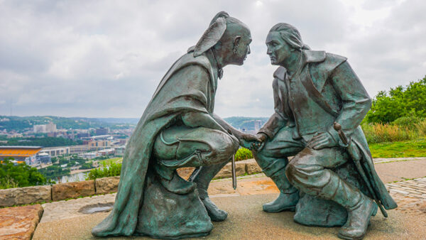
After a very quick walk up the hill you'll find yourself at the Point of View Statue across the street from Monterey Bay Fish Grotto. This bronze statue was constructed in 2006 by James A. West and depicts George Washington meeting with Seneca leader Guyasuta which was said to have taken place somewhere in the region (not specifically at this spot).
George Washington actually triggered a fair number of key events in western Pennsylvania, and some could say these events helped lead up to the Revolutionary War and our inevitable break from Britain.
Still, we think this statue is a beauty and the view of the city from it is one of our favorites. Something about looking out over the hill without any railings like you have at the incline is simply wonderful!
From there, turn back the way you came. We're now on a one-mile walk down Grandview Avenue to the upper station of the Monongahela Incline. You won't get lost because this one is on Grandview as well, so keep going straight.
Optional Detour: If you need a snack and they are open, Monterey Bay Fish Grotto's bar level offers stellar views, their food and drink menu, and one of our favorite desserts in the city- the Angel Food Grilled Cheese Sandwich. Note that this is a higher-end establishment with a more formal dress code, but the lower level bar is fairly welcoming all the same. This detour can last 30 to 60 minutes or more.
Grandview Avenue
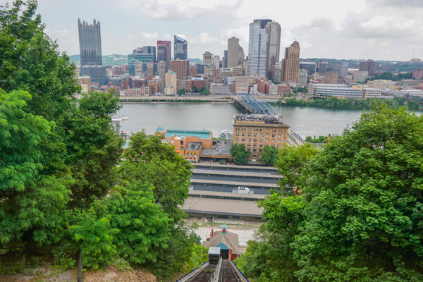
After about a half of a mile walking down Grandview Avenue, you'll cross an intersection with PJ McArdle Roadway. After passing this road, more stellar views of the city open up at a different angle than at the Duquesne Incline.
While walking down Grandview Avenue, you'll have the option to walk out onto some lookout platforms for even better views, and after taking in the skyline for your liking it is time to continue walking to near the end of Grandview Avenue to ride the Monongahela Incline down the mountain.
Optional Detour: Shiloh Street and a few cross-streets nearby have more affordable bars and restaurants than the higher-end spots near the Duquesne Incline. If they're open, a cocktail at The Summit is always a good call and Coughlin's Law (off of Virginia Avenue a few blocks down) have good gastropub menus. If you are in the mood for a quick snack, Grandview Bakery is always worth a stop for their amazing lemon bars. This detour can last as long as you want pending where you go.
Monongahela Incline
When you're ready, board the Monongahela Incline to take a ride down to Station Square. This incline was built in 1870 and is considered to be the oldest operating funicular in the United States. Today it is often used by those who live in Mount Washington and commute to downtown and has a fair bit less tourist traffic than the Duquesne Incline down the road.
This incline is also part of the Pittsburgh Regional Transit system (formerly Port Authority), so if you are taking public transit at all you may want to pay with a ConnectCard to get a transfer within 3-hours of riding the incline for a nominal extra fee (about $1). Transfers do not apply on the Duquesne Incline which requires its own payment.
When exiting the lower station of the Monongahela Incline, turn right on West Carson Street. The intersection immediately in front of you will be Smithfield Street. Cross the street (heading north) and walk down Smithfield Street towards the Smithfield Street Bridge.
Smithfield Street Bridge
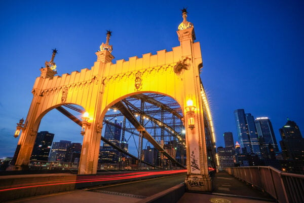
This bridge is one of our favorites in the city (which is saying a lot since we have 446- more than Venice, Italy!) and was first built between 1881 and 1883. The original wooden bridge was replaced with the wire bridge which was created by John A Roebling- a German immigrant who lived in Saxonburg just about an hour outside of the city.
Roebling used his wiring rope in many large bridges around the country including the John A Roebling Suspension Bridge in Cincinnati and the Brooklyn Bridge in New York. Today the Smithfield Street Bridge stands out amongst Pittsburgh's primarily yellow-painted bridges and is a favorite of many.
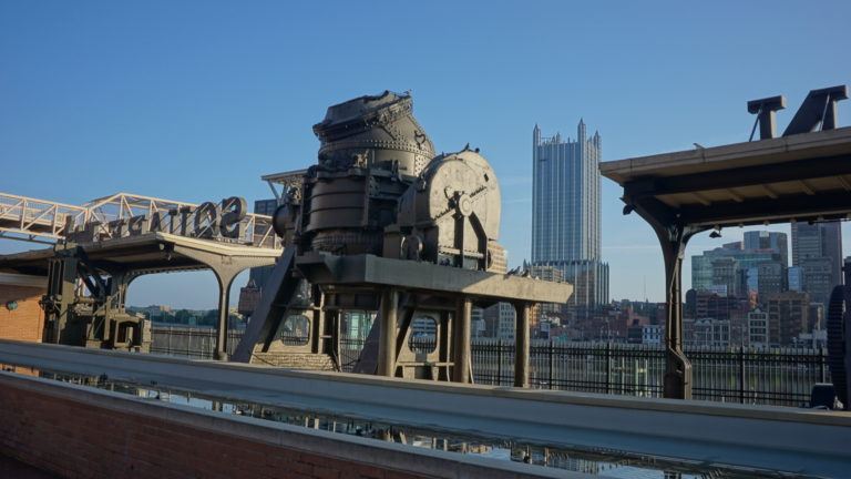
Optional Detour: Before crossing the Smithfield Street Bridge, you can turn left and head into Station Square. This small area of Pittsburgh's South Side is home to the Pittsburgh Riverhounds soccer team (at Highmark Stadium), the docking point for the Gateway Clipper river cruises, and, we have to admit, a number of chain restaurants (although brunch at The Grand Concourse is always an opulent treat). To us, the real highlight worth seeing in Station Square is an old Bessemer Converter for the production of steel used as a centerpiece within a fountain just a few steps away from Smithfield Street on your left (west). If detouring here for the fountain, add on about five minutes.
The City-County Building
After crossing the Smithfield Street Bridge, you will be back in downtown proper. At the end of the bridge, you should make sure you are on the eastern side (right-hand side as you cross). At the intersection of Fort Pitt Blvd there will be two pedestrian pathways. One is a ramp down that will go to the river trail at the Monongahela Wharf, and the second follows a curved path along Fort Pitt Blvd. You should follow this second path.
As the path curves around, you'll cross an intersection and then be facing north on Grant Street. Continue walking down Grant a few blocks, cross Boulevard of the Allies, and two blocks later you'll reach the City-County Building.
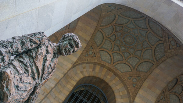
This building is home to Pittsburgh's city and county governments and is a gorgeous piece of architecture with a large, domed entryway. Outside the entryway is a second statue by Robert Berks (who did the Mr. Rogers Statue at our first stop) of Richard S. Caliguiri- mayor of Pittsburgh from 1977 until 1988. Mayor Caliguiri helped launch Pittsburgh's “Renaissance II” plan which focused on many of the urban renewal efforts we enjoy today.
Tours of the City-County Building are appointment based, but we always recommend checking out Doors Open Pittsburgh as they periodically offer tours that go inside here!
When you're done here, turn back around the way you came and head to Fourth Avenue (at the corner). Turn right and head west on Fourth Avenue.
Optional Detour: If you continue down Grant Street in the original direction you were walking (north), you'll see the Allegheny County Courthouse at the next intersection. This a Romanesque Revival style courthouse complete with its own Bridge of Sighs on Ross Street (on the back-side of the building from where you will be standing). Walking around the Courthouse to check out its architecture will take an additional five to ten minutes. While on the Grant Street side, be sure to look at the Frick Building opposite the Courthouse. This street was once a small hill and street-level was story above you until 1912- you're actually standing where the basement originally was! (This is most noticeable on the Frick Building.)
Fourth Avenue's Historic Architecture
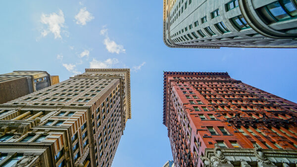
Fourth Avenue is our favorite cross street to walk on in downtown Pittsburgh as it has a large concentration of amazing architecture to check out- specifically around historic bank buildings as this street was Pittsburgh's banking district.
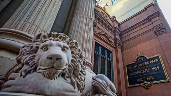
We'll let you be the judge on what building is your favorite, but ours is most certainly the historic Dollar Bank building which was built in 1870 with two massive Portland brownstone lions out front. In 2012 the original lions were moved inside (where you may be able see if the bank is open or during Doors Open as mentioned above) and hand-carved replicas were installed in 2013.
When walking down Fourth Avenue, be sure to look up, down, and even behind you as the architecture here is simply awe-inspiring. Keep walking down this street for a few blocks and you'll find yourself in PPG Place's central courtyard.
PPG Place
Pittsburgh may be known as the Steel City, but for a while, we were a glass production hub as well. One company to come out of this industry was PPG, formerly Pittsburgh Plate Glass, which was founded in 1883 and grew to have over 100 manufacturing locations all over the world. (Since then PPG has divested their glass business and focuses more on paints and coatings.)
Their headquarters, constructed between 1981 and 1984, showcases glass in the best way possible as it covers almost every single square foot of the building. Couple in the fact that the property spans several blocks and has a unique design with spires (over 200 in total), a courtyard, and more, and you may not be surprised to hear that in total the complex has over one million square feet of glass!
In the summer months, the central courtyard often has a fountain and stone obelisk and in the winter PPG Place comes to life with an ice skating rink and massive Christmas tree.
After taking in PPG Place, you'll exit the plaza by crossing Fourth Avenue north and passing through the pedestrian walkway directly into Market Square. (As you were walking down Fourth Avenue coming into PPG Place, this would be on your right coming off the center of the plaza).
Market Square
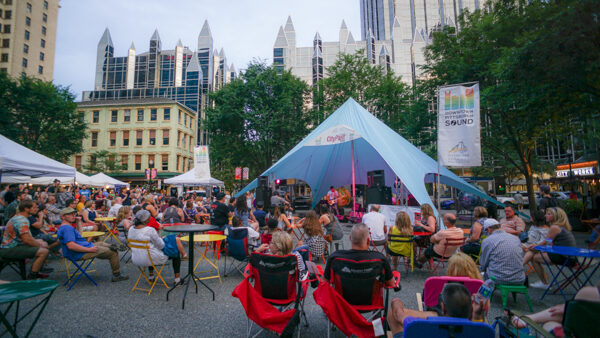
Market Square is one of the historical centers of downtown Pittsburgh. This square was originally named Diamond Way and was the hub for the city's first courthouse, jail, newspaper, and more. Now Market Square is a fairly popular dining and entertainment hub with many restaurants being found here (a mix of local spots and chains). While walking through the square, you also get some great views of PPG Place, Fifth Avenue Place (with the Highmark logo), and The Tower at PNC Plaza- one of the most energy-efficient skyscrapers in the world.
Beyond dining and the views, you never know what art piece or musician you may find in Market Square. Beyond this, the square has frequent market pop-ups and in December this plaza comes to life with a Christmas market containing several dozen vendors (our favorite time of the year here).
💬 Join Our Facebook Groups
Join Things to Do in Pittsburgh and Pittsburgh Photography for more local content!
After you're done checking out Market Square, keep walking north on a straight line through the same path you entered. This will take you through Market Street. Take this road two blocks and you'll find yourself at the intersection with Liberty Avenue. Turn right here and walk down 1 1/2 blocks. We're going to cross the street to the other side of Liberty Avenue and head down the alley just past 7th and behind the Benedum Center- Tito Way.
Optional Detours: Within Market Square there are a number of restaurants including Primanti Brothers, The Original Oyster House (the oldest restaurant in Pittsburgh), the Mexican restaurant Las Velas, Pizzaiolo Primo, City Works gastropub, and many, many more. If a cocktail is more your speed, The Warren on 7th and Liberty Avenue offers stellar cocktails at very attractive prices and Space Bar in Market Square has unusual cocktails you are unlikely to find anywhere else.
If you are in the mood for a sweet treat- local ice cream shop, Millie's, can be found a half-block east of the square on Forbes Avenue.
Or, if you'd rather check out an art gallery, SPACE and Wood Street Gallery can both be found on Liberty Avenue and have rotating exhibits if you can catch them when they're open (and are free!). Detours here can last as little as a few minutes to up to an hour or more.
Tito Way and Cell Phone Disco
The slight detour to Tito Way is worth it to see two great art installations in the alley behind the Benedum Center.
The first is a selection of art exhibits hung throughout the alleyway that often contains deep and thought-provoking imagery (we've seen these rotate over time, so we're going to be general here in case the art changes). The second is the permanently installed Cell Phone Disco. This installation features a 16×16′ glass panel with over 2,000 LED lights. Antennas on-site pick up the electromagnetic field around an active mobile phone and cause the LED lights to dance around the screen.
We'll be the first to note that this exhibit is somewhat prone to issues. We've walked through the alley sometimes when it is not on or misfiring, but sometimes you may get lucky and it works and presents a cool scene all the same. Despite the variable odds if this exhibit is fully functional, the other artwork found in this alley makes it a worthy detour all the same.
After you pass through the alley, you'll find yourself on Penn Avenue. Turn left and walk for a few more blocks to stroll through the Cultural District.
Note: Sometimes when the Benedum is changing sets for shows there will be many cars and trucks in the alley which would make passage tricky. If this is the case, you may want to turn around and head back to 7th, turn right at The Warren, and then turn left on Penn Avenue.
Theaters in the Cultural District
While our walk through the Cultural District may be brief, by strolling down Penn Avenue from Tito Way to 6th Avenue you'll pass Agnes Agnes R. Katz Plaza, the 7th and Penn Parklet (with a gorgeous piece of art), the Benedum Center, Agnes Katz Plaza, the O'Reilly Theater, and Heinz Hall to name a few (with the two big theaters being on the cross streets of 7th and 6th respectively on your left-hand side).
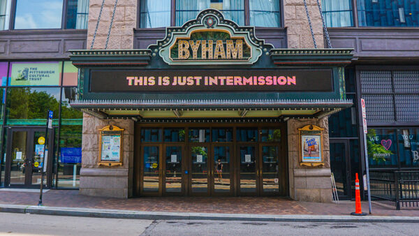
In most circumstances, there is likely a show going on at one of the theaters nearly every day of the year, and this stretch of the district is always bustling with activity. When you reach 6th Avenue (after taking a look at the architecture of Heinz Hall), turn to your right and walk down 6th to the Clemente Bridge. On your way you'll pass the Byham Theater and will round out your quick walk through the Cultural District.
Optional Detours: The food scene in the Cultural District is quite robust. The Richard DeShantz Restaurant Group has a number of higher-end restaurants in this part of downtown (including Meat and Potatoes and Tako to name a few) and one of our favorite restaurants, the Argentinian barbecue Gaucho, can be found along the route as well. The DeShantz restaurants typically require reservations and are a bit more high-end, whereas Gaucho is a bit more approachable for walk-ins. If you're in the mood for a quick drink instead, Braddock's Streetside at the Renaissance Hotel right next to the Byham offers some great cocktails. Detours here can last up to an hour or more.
The Three Sisters Bridges
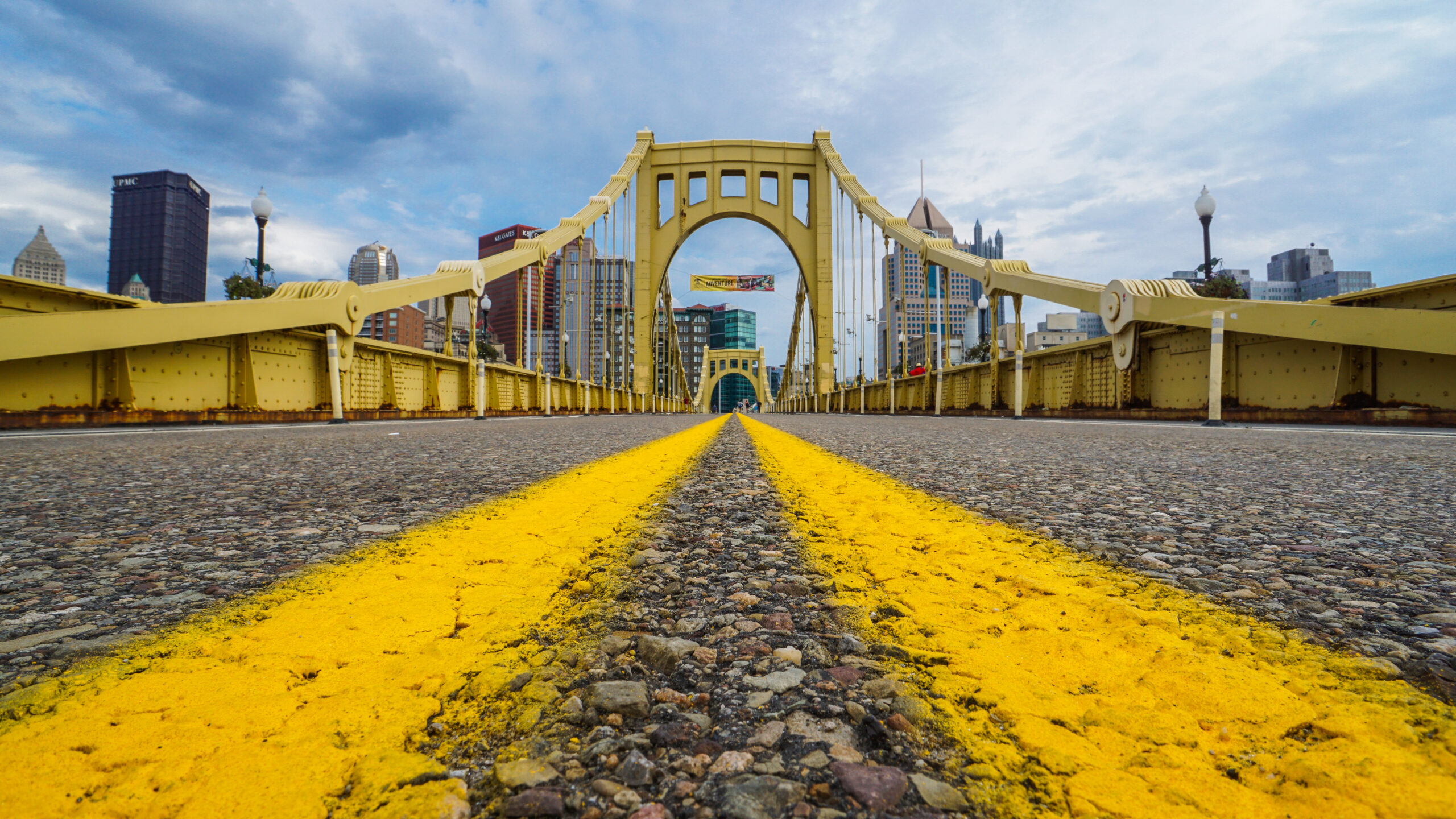
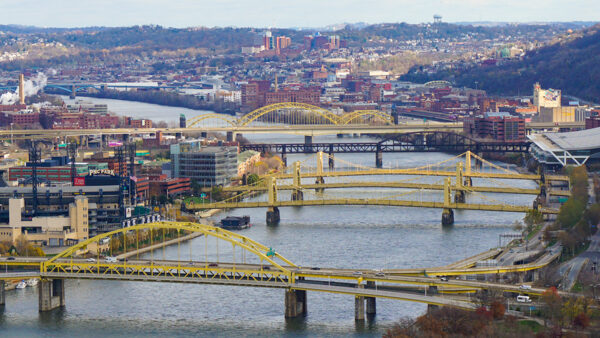
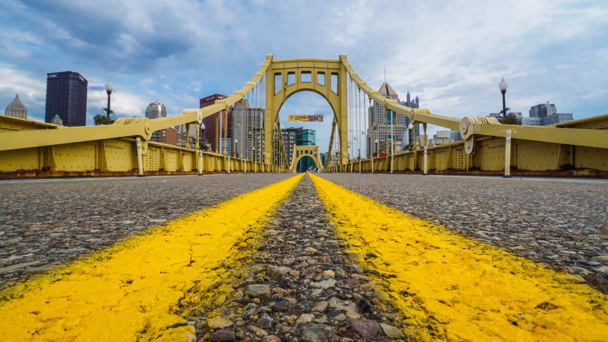
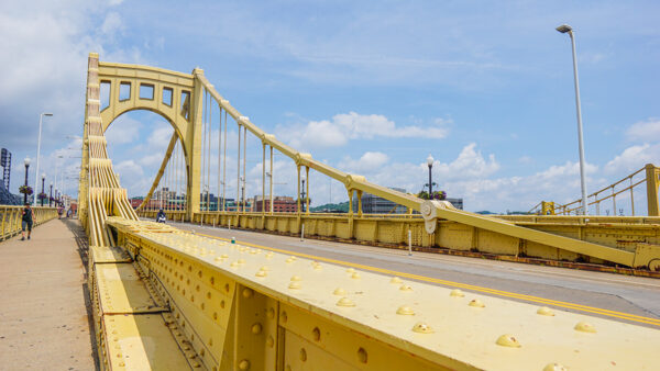
As you exit the Cultural District on 6th Avenue, you'll cross the road and see the first of the Three Sisters Bridges in front of you. These three bridges are said to be the only identical triplet pair of bridges in the country and are an icon of Pittsburgh's downtown.
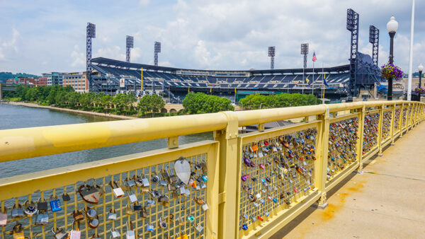
The bridge directly in front of you is the Roberto Clemente Bridge, named for the famous Pittsburgh Pirates player from the mid-50s to the early 70s. Crossing this one will take you directly to PNC Park. The second bridge is the Andy Warhol Bridge, named for Pittsburgh's most famous artist. Crossing this one will take you directly to the Andy Warhol Museum (the largest museum in North America dedicated to a single artist). The final bridge is the Rachel Carson Bridge, named for the activist Rachel Carson who wrote Silent Spring- a blockbuster book about the harmful effects of the use of pesticides (this book was one of the big drivers for the founding of the EPA).
Pick a bridge to cross (we like the Clemente near PNC Park) and continue on.
Optional Detours: After crossing the bridge, the street becomes Federal Street. A few restaurants and bars can be found here including Slice (pizza) and Mike's Beer Bar (a great craft beer selection). Detours here can be just a few minutes for a slice of pizza or longer for a beer.
PNC Park
As soon as you cross the bridge, on the right hand side of the street there will be a path that will take you back down to the Three Rivers Heritage Trail. Once you reach the river trail, turn right, and make your way towards the Fort Duquesne Bridge that you crossed at the start of this walking tour.
Optional Detours: We recommend going on the North Shore River Trail to finish the tour. But you have a few other options here. If you are especially interested in Pirates history, walking the perimeter the long way around will let you see statues of Roberto Clemente, Willie Stargell, Honus Wagner, and Bill Mazeroski as well. This detour may add on an extra five to ten minutes. Likewise, sometimes PNC Park has their riverwalk path open for the public to walk through (right behind the Clemente Statue) and could offer some great views into the park on non-game days. Exact hours tend to not be posted so planning on this one being open is hard.
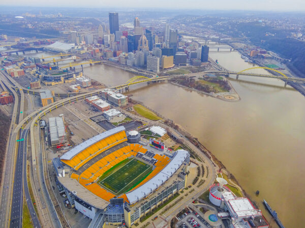
Acrisure Stadium (Formerly Heinz Field)
To end this walking tour of Pittsburgh, we continue back to where we started- the Mr. Rogers Statue on the North Shore River Trail (about a ten-minute walk from PNC Park). While on the trail you'll get stellar views of the city, the ability to spot a few war memorials, the water steps, and get a great view of Acrisure Stadium as you approach the Mr. Rogers Statue to end your walk!
Optional Detours: When you walk down the steps from PNC Park to the North Shore River Trail, if you want to take a short walk on the path to the left you'll pass underneath the Sister Bridges. We love this view and think its perhaps the best view from the city on all of the river trail. This detour could add on five to ten minutes. Likewise, when your tour is over you can also explore more restaurants on the North Shore and continue on with your day!
Overall, this walking tour hits some of our favorite sights in Pittsburgh all within an easily accessible five-mile loop. As mentioned at the start of this article, even the fastest of walkers may take 2.5 to 3 hours to complete this route, but you should plan on extra time for any and all detours as mentioned in their respective sections. You really could make a day out of this one!
What are your favorite sights to see on the walking tour of downtown Pittsburgh? Comment below to share!
Pittsburgh Discounts and Promotions
In the mood for a sale? Or perhaps you simply want to try out something new? Check out our latest Pittsburgh promotions below!

🧥 Get 10% Off at Steel City — code DISCOVERTHEBURGH

🍎 $40 Off your first box from Harvie

🏨 Up to 15% Off at The Oaklander

🌿 20% Off foraging classes at Wyld Forest

🖼️ 15% Off Carnegie Museums membership — code MEMDisctheBurgh15
🧳 $20 off 4-day luggage transfer on the GAP and $30 off 8-day transfer on the GAP & C&O with Sunshine Luggage Shuttle — mention Discover the Burgh when inquiring.
Are you a local business that would like featured? Click here!
Find a Hotel Deal
Looking for an apartment rental? Click here to find a deal on Airbnb!







Is there any printable versions of the map with step by step instructions?
Unfortunately we do not have any printable editions at this time, but we will put this on our to-do list for our next update.
Walked this tour on a recent stop In Pittsburgh. We loved it! Bypassed the inclines (did that last time we were here), but enjoyed the walk along the river to the Smithfield Street Bridge. Loved getting a taste of all the different areas. And LOVED Fourth Ave and the bank buildings. Thank you for a great tour!
So glad you liked it! We are also pretty excited how its easy to skip the Inclines if you want to do those separately. A great alternative option!
Can’t wait to do this when I visit Pittsburgh. Thanks for putting it together.
Really enjoyed this walking tour but we ended up with 6 miles. FYI 6th street bridge (three sisters?) was closed so crossed on 7th street bridge (Andy Warhol). Also, beginning Aug 1st the Monongahela Incline will be closed for 4 months.
Thanks for the update. We didn’t see that news about the Incline until you commented. Going to update now!
Had a great time with some visiting out-of-town friends following your downtown tour this past weekend, including the optional detours. Recommend adding Mellon Square and the Union Trust Building – both recently restored.
Came to Pittsburgh for the first time to attend a wedding and had several hours between hotel checkout and the flight home. Accidentally stumbled across this website and this walking tour which starts right near the hotel. We only did it as far as the Duquesne Incline (round trip) then back again but it was so much more than we would’ve done on our own. We thank you very much for putting this together and sharing it with us. It was wonderful and if we ever come back to Pittsburgh we will complete the tour! Much appreciated!
We are so glad you got to check out a bit of the city when coming in for a wedding. Thanks so much for the kind words!
I am planning a trip to Pittsburgh (my first time!) in October and this is EXACTLY what I was looking for. Begins and ends near my hotel, includes all the things I wanted to see most, some of the restaurants I was looking at are listed… plus lots of suggestions I didn’t even think of/know about. Thank you so much. This is awesome and I plan on making this my day 1 priority!
Thanks for some great suggestions. It was just what we were looking for, with the right mix of river and city. The only hiccup was the path along the Monongahela being under construction, but we took the path past Highmark Stadium as an alternate to that alternate.
We loved the tour! The route was great and the views magnificent. Only problem was getting on the Fort Pitt Bridge from Point Park as one of the sidewalks was closed but we got some help from a friendly city employee who pointed us in the right direction. Thanks so much for a great walk!
I had a 4 hour work meeting to listen to sooooooo…..
I walked your whole tour as I listened. You have this Coloradan anxious to come back for another visit and see more
That is a great way to enjoy a meeting. Hope you make it back soon!
Took you excellent tour on my first visit to Pittsburg. It took me much more than the time indicated, because so many spots deserve appropriate time: the Terminal Station, the Dollar Savings Bank, the Point State Park, the Fort Pitt Museum… Thank you for the most useful advice.
Thank you so much, and appreciate the feedback on the tour taking longer. I will update to increase our time estimate accordingly!
My daughter and I did your 17+sites, 5 mile walking tour Sept 28, 2024 and it was excellent. We started at Tito’s Way and Cell Phone Disco (which was working) as this was close to our hotel. The route and descriptions were easy to follow and we did many of the optional detours. The line for the incline was long, so we skipped that so overall spent about 4 hours. Great way to spend the afternoon!
Restaurant suggestions were also helpful. Went to Tako’s for dinner.
Thank you for spending the time to put this together.