Published by Jeremy. Last Updated on August 25, 2020.
Disclaimer: Our site uses demographic data, email opt-ins, display advertising, and affiliate links. Please check out our Terms and Conditions. Pricing, operating hours, or menus may have changed since our initial visit and may not be reflected in subsequent updates. Please confirm these directly with any business prior to visiting. To see more of our content, set us as a Preferred Source in Google.
The Butler-Freeport Community Trail is a converted rail trail that opened in 1992. The trail spans approximately twenty miles between the outskirts of Butler and Freeport and offers a great opportunity to surround yourself with nature on an easy-to-navigate path.
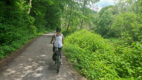
We took our bikes out on this one and did an out-and-back ride on the entire trail, and in this one we wanted to share a bit more about what it is like!
🏨 Book a Hotel in Pittsburgh
- Great Value: Drury Plaza offers excellent prices downtown.
- Good Views: Sheraton Station Square features stellar views from river-view rooms.
- Free Parking: Hampton Inn Strip District includes free parking and a great location.
🏡 Looking for an apartment rental? Find a deal on Airbnb!
What You Can See on the Butler-Freeport Community Trail

Save This Article!
As the Butler-Freeport Community Trail stretches approximately 20-miles, there are certainly a number of things you can see along the way. To us, we can break this trail up into two distinct halves that we will call the Butler half and Freeport half respectively.
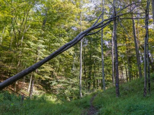
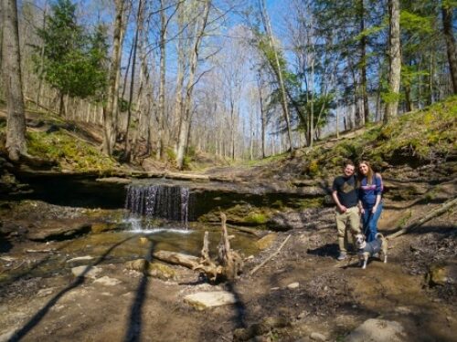
For those who like to be out in the woods, the Freeport half of the trail should be on your radar. The section of the trail closest to the borough follows along Buffalo Creek and has many beautiful trees, rock formations, and stellar views of the winding creek. This continues for about half of the trail with some of the more stunning views being seen within the first few miles of Freeport proper where the creek is at its widest.

For those who like to be out in rolling hills and farmland, the Butler half of the trail is for you. The trees thin out a bit at this section of the trail and allow for views of sweeping vistas and several active farms just feet away from the path.
Beyond these two points, the scenery change along this trail is fairly gradual. If one of these general vistas is of more interest to you, odds are good you'll be happy picking one side of the trail and exploring it if you are only able to traverse a short distance.
Hiking and Biking on the Butler-Freeport Community Trail

For those who want to visit the Butler-Freeport Community Trail to walk, you will have an easy outing on your hands. This rail trail is fairly flat throughout the 20-mile path and frequent access points every mile or so gives you many spaces to enter and explore. The trail is fairly wide apart from a small section near Butler, quiet, and makes for a lovely outing out-and-back on foot.
Mileage markers are present every 0.5 to 1.0 miles depending on the section; however, we have to admit that it seemed like the markers were a bit off in their overall distances compared to our GPS but were close enough to follow all the same. (We wondered if these were illustrating the distance to Freeport and Butler centers as opposed to the trailhead, which is about an extra 0.2 miles and 1.0 miles respectively.)

When we visited this trail, we explored it by bike and did the entire 20-mile route both ways in about 4 1/2 hours (roughly 40 miles in total). While many of the same comments on walking the trail apply to bikers, it is worth discussing the grade of the trail just a bit more as bikers will most certainly notice it on long rides.
Generally speaking, most of the Butler-Freeport Community Trail is flat. However, you do ascend about 650 feet over the course of the trail. If traveling from Freeport to Butler, this is done over about 75% of the trail in a nearly indiscernible gradient up. The last quarter of the trail offers a downhill ride into the Butler trailhead. If traveling in the reverse, you'll notice a few uphill segments when leaving Butler and a mostly flat ride the rest of the way.
So while we can safely say that this one has relatively easy grades throughout the entire ride, if you do not like any hills at all (no matter how small), you would do well sticking to the Freeport end of the trail over the Butler end overall. But we do need to reiterate that this is all fairly minor commentary all the same.

Beyond this, the trail is comprised of crushed limestone that is generally compact and fairly easy to ride on; however, there may be a few spots here or there where the trail is a bit uneven or the limestone is not perfectly settled so you would do well to keep your eyes open. During our visit the section about 3-5 miles out of Butler had a few areas we had to slow down for, but we think this may vary based on season and repairs being done. Likewise, the trail primarily runs north-south and has a good amount of tree cover for shade during the ride which we thoroughly appreciated.
There is also one convenience store (the Derailleur Bike Shop Cafe) located roughly five miles away from the Butler trailhead which offers bike services, food, snacks, and more. If you would like to pick up snacks there, you would do well to reconfirm their hours prior to hitting the trail.
Overall, the Butler-Freeport Community Trail is a lovely path that begs being explored both on foot and by bike. We loved the gradual scenery change on this one and look forward to making it a regular in our expanding biking rotation in the coming months.
The Butler-Freeport Community Trail is a 20+ mile rail trail. There are several parking areas along the trail every mile or so, with some of the biggest ones being located at the terminals on both ends (two in Freeport on Main Street and one in Butler on Kaufman Drive by Father Marinaro Park). It is worth noting that we visited on a fairly busy weekend and the two parking lots in Freeport were full; however, the next parking area a half-mile or so up the trail still had spaces. So if the lot you wish to visit is full, you may have luck further out on the trail.


I loved meeting you at Picklesburg. I enjoy and have shared your site with many ppl. Keep up the good work on this site. 👏👏👏