Published by Jeremy. Last Updated on July 8, 2022.
Disclaimer: Our site uses demographic data, email opt-ins, display advertising, and affiliate links. Please check out our Terms and Conditions. Pricing, operating hours, or menus may have changed since our initial visit and may not be reflected in subsequent updates. Please confirm these directly with any business or attraction prior to visiting.
The aptly named Armstrong Trail in Armstrong County is a 35-mile rail-trail that runs north to south along the eastern bank of the Allegheny River.
During our first visit, we biked half of the trail (approximately 16 miles one-way out of Ford City) and were able to see many highlights including river views and adjunct river developments like power stations, dams, an iron furnace, and more.
So in this one we wanted to share a bit about what you can see when exploring the Armstrong Trail and also give some tips for making the most out of your ride on this exceptionally flat trail.
What You Can See on the Armstrong Trail
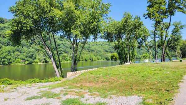
While the primary highlight of the Armstrong Trail is its views of the Allegheny River, we have to admit that the views of the river do not open up well until after you pass Kittanning- roughly seven miles north of Ford City. Up until this point, the views are predominantly housing developments with very few glimpses of the river off in the distance.
The highlights also get more and more interesting as you get closer to East Brady, so depending on the distance you wish to bike it may make more sense to either start on that end or pick a trailhead much further up the path. (You can see a list of all the highlights on the trail map here to get an idea.)
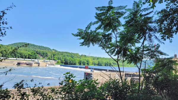
So, what can you see? Just north of Kittanning, you have the ruins of the Monticello Iron Furnace, the Mosgrove Railroad overpass, and Lock & Dam 8 to name a few. As you get closer to East Brady, you have Lock & Dam 9, a train turntable, a tunnel, and more.
While these highlights are spaced out at roughly one to two-mile intervals, again benefiting those who can cover long distances, views of the Allegheny River remain a prominent focal point throughout the trail north of Mosgrove which made for quite the peaceful scene.
Biking on the Armstrong Trail
For what it is worth, the Armstrong Trail is perhaps one of the easiest bike trails in southwest Pennsylvania.
It is flat. Exceptionally flat. It is so flat that the only grade changes of note are when you have to cross a road where, at times, there is a dip or rise of just five or six feet. Suffice it to say, biking on this one really is a breeze.
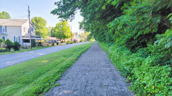
That being said, it is worth noting that the trail frequently switches between pavement and crushed limestone- with paved sections typically being found in and around Ford City and Kittanning. While very easy to bike on all around, not all bikes may be best equipped for the gravel segments which, in a few key spots, felt a bit loose. Likewise, some of the paved segments were fairly cracked during our ride which, while not terribly difficult to navigate, is of note.
Apart from that, well, you're going to have an easy time on this one!
We look forward to a return visit to the Armstrong Trail in the future where we will begin at the East Brady trailhead and work our way south to see the rest that we did not manage to bike in our first outing.
The Armstrong Trail runs for approximately 35 miles from Ford City to East Brady.
Looking for more great bike trails near Pittsburgh? Click the previous link to check out some of our favorites!


I enjoy ready your posts… I live in the Kittanning area and wanted to thank you for highlighting the Armstrong Bike Trail