Published by Jeremy. Last Updated on March 9, 2026.
Disclaimer: Our site uses demographic data, email opt-ins, display advertising, and affiliate links. Please check out our Terms and Conditions. Pricing, operating hours, or menus may have changed since our initial visit and may not be reflected in subsequent updates. Please confirm these directly with any business prior to visiting. To see more of our content, set us as a Preferred Source in Google.
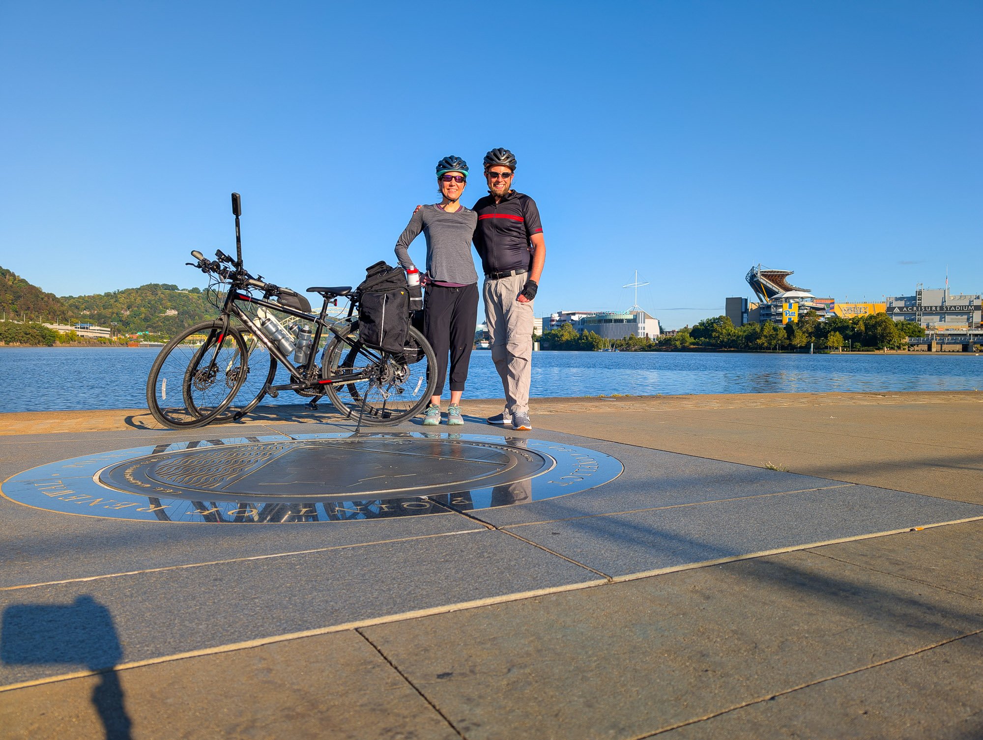
One of our favorite activities on a nice day in Pittsburgh is hitting one of our many area bike trails.
Naturally, one trail we ride on the most is the famous Great Allegheny Passage, which spans 150-miles from Pittsburgh to Cumberland, Maryland, where it subsequently connects to the C&O Canal Towpath and continues on to Washington DC for a roughly 335-mile total ride.
For many years, we would ride the GAP in short segments, tackling 20-40 mile round-trip rides here or there. But we always wanted to do the entire bike ride from Pittsburgh to Washington DC, and finally made our dream a reality with a fun, six-day ride in September 2025.
So in this one, we wanted to go down the rabbit hole of everything you need to know when planning to bike from Pittsburgh to DC. Buckle up, because we do mean everything here!
Note: Most of the commentary in this article is based on our experience biking and staying in B&Bs along the way. While we will discuss camping options briefly, our itineraries are built around staying in dedicated accommodations every night.
The GAP and C&O Canal Towpath Make for a Fun 335-Mile Ride

Save This Article!
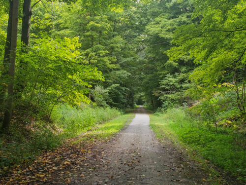
When talking about biking from Pittsburgh to Washington DC, we will frequently break up the discussion into two parts- the 150-mile ride on the Great Allegheny Passage from Pittsburgh to Cumberland, Maryland, and the roughly 185-mile ride on the C&O Canal Towpath from Cumberland to Washington DC. While distinctly separate with many unique characteristics worth breaking down in greater detail, they connect Pittsburgh to Washington in one mostly seamless trail.
Numerous train lines used the Great Allegheny Passage over the years, while the Chesapeake & Ohio towpath was used to pull boats through the canal that runs (mostly) alongside the Potomac River.

Now, these two trails are purely for recreational use for walkers, runners, bikers, and more while offering incredible views of the likes of the Youghiogheny River, Ohiopyle State Park, the Eastern Continental Divide, the Mason-Dixon Line, the Potomac River, the old locks and lockhouses, and more stunning nature (and some city) views along virtually every mile.
For many, the Great Allegheny Passage is often considered a more enjoyable trail from a riding standpoint, as it is often a mix of paved segments and fairly uniform crushed limestone. The C&O Canal, on the other hand, is a bit all over the map with segments like these, but also rougher gravel (think a rural gravel backroad), sand, and more. While still quite doable from a biking standpoint, this stretch is often associated with greater challenges- particularly during inclement weather.
These details, amongst many others, will be discussed at length in this guide.

While this article will dive into planning for those who are looking to bike from Pittsburgh to Washington DC on your own, we'd be remiss if we didn't also point out that there are many organized tours that take a lot of the logistics out of planning- with some itineraries including accomodations, having a guide and/or other bikers with you, a support vehicle, meals, return transfers, and more. Likewise, you can also bike just the Great Allegheny Passage, or just the C&O Canal, and have a great time- we just decided to do both for the full ride.
Companies that offer organized tours could be good for those who want a bit more support and safety nets (or need a bike rental!); however, they do come at a premium. We opted to plan and book everything ourselves to save on costs and ride on our own bikes, but we did meet several other riders who were happy booking a complete package. If you need a company for rentals or tours near Pittsburgh, we are big fans of Golden Triangle Bike Rental.
So, let's talk about everything you need to know when planning your ride!
Which Direction is Better? – Pittsburgh to DC or DC to Pittsburgh

Naturally, the first question you want to consider is whether you'll start in Pittsburgh and end in Washington DC (heading east), or start in Washington DC and end in Pittsburgh (heading west)?
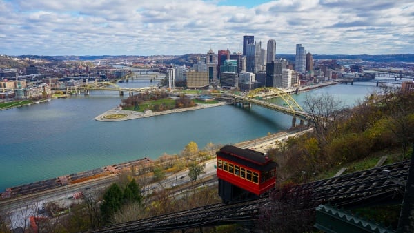
Given that we live in Pittsburgh, it was an easy decision for us to start from our house, just a few miles from Point State Park, and head east to DC. If you are reading this and live in Washington DC or nearby, we could see a compelling argument for starting there and heading west for the very same reason. Convenience is a very powerful deciding factor.
For those coming in from out of the region for the ride and could go either way, we have a few more practical considerations to keep in mind.
Perhaps the biggest challenge for those riding west from Washington DC to Pittsburgh is tackling the climb on the Eastern Continental Divide on the GAP. This 22-mile hill just west of Cumberland, Maryland, has approximately 1,787 feet of vertical gain when biking west, while offering a fun descent into Cumberland for those going east.
We like to make things easier for ourselves, and we were glad the descent was in our favor starting in Pittsburgh. Over those 22 miles downhill, we put very little effort in and let gravity do a lot of the work for us.

That said, it was still a fair climb to get to the Eastern Continental Divide when heading east, too. By our estimates, we had a very gradual uphill ride for 75+ miles from before Connellsville to the divide, which adds up over time. (Conversely, if you're heading west, you do get a long, albeit gradual, downhill stretch as your reward for the massive climb!)
Outside of this, both directions have a sufficient vertical climb throughout the entire ride, but Pittsburgh to Washington DC has about 700 feet less in overall elevation gain- about a 10% difference at most in the grand scheme of things.
From there, the differences are very minor. The C&O trail is not as good quality-wise as the GAP, and the trail's end in DC is a bit lackluster compared to Pittsburgh's incredible skyline. Are there merits to doing the C&O first when you're a bit fresher or to have Pittsburgh be an arguably better ending? Perhaps, but these are minor in the grand scheme of things.

So, which direction is better? Honestly, the answer is really up to you.
We met bikers who have gone east and had a great time. We have met bikers who have gone west and have had a great time. We've heard stories of bikers doing both directions and giving up for an untold number of reasons, too. You will have challenges when heading east. You will have challenges when heading west. It is just what type of challenge you want to accept that may sway you one way or another.
But unless you're really okay with climbing the Eastern Continental Divide's 22-mile uphill slog going west, you can likely surmise why so many choose to bike from Pittsburgh to Washington DC- ourselves included.
How Many Days Does it Take to Bike from Pittsburgh to DC?

Once you have decided on a direction, the second most important question is to determine how many days you need to bike from Pittsburgh to Washington, DC.
The answer can vary significantly, and it really depends on how much you like to bike, how long you like to bike in any given day, if you'll be camping or not, and your risk tolerance for dealing with things like bad weather or other one-off trail issues.
To put it bluntly, some bikers can do the entire ride in just a few days. Some take a week or more. A few have done it in under 24 hours.
The correct answer here is to set a pace that makes sense for you, and when in doubt, fall back on the logic that more time is always better than less unless you really know what you're getting yourself into.
In three days, you'd be averaging 100+ miles a day. That likely means upwards of 10+ hours a day on the trails, and little margin for error for flat tires, trail closures, or bad weather. With six days of biking, like we did, your average daily ride may drop to 40 to 66 miles, which, while still big biking days, gives you much more room to enjoy the highlights, take breaks, enjoy lunch and snack stops, account for rain delays, and enjoy a more leisurely pace. With a week or more, you may even consider a day or two off to relax along the way, too.
We can't tell you what is right for you, but in all honesty, we can't see biking in anything faster than five days. It's just a lot, and there is no other way to say it.
But no matter what you may be interested in, we have some route ideas to consider that will have you ending in modestly sized towns with some form of amenities at the end of the day. Please note that mileage amounts are estimates and may be off a little here or there.
2 nights, 3 days (100+ miles per day): Pittsburgh, Rockwood (106 miles), Hancock (104 miles), Washington DC (129 miles).
3 nights, 4 days (62-88 miles per day): Pittsburgh, Confluence (88 miles), Cumberland (62 miles), Williamsport (84 miles), Washington DC (84 miles)
4 nights, 5 days (59-76 miles per day): Pittsburgh, Ohiopyle (76 miles), Cumberland (72 miles), Hancock (59 miles), Harpers Ferry (66 miles), Washington DC (63 miles)
5 nights, 6 days (45-66 miles per day): Pittsburgh, Connellsville (60 miles), Rockwood (46 miles), Cumberland (45 miles), Hancock (59 miles), Harpers Ferry (66 miles), Washington DC (63 miles) – We did this route
6 nights, 7 days (25-62 miles per day): Pittsburgh, West Newton (35 miles), Confluence (54 miles), Cumberland (62 miles), Hancock (59 miles), Williamsport (25 miles), Harpers Ferry (26 miles), Washington DC (61 miles)
- Notes: If you want to add on extra days for rest, Ohiopyle and Harpers Ferry have a lot to see, and are the two places we would've wanted more time if we hadn't visited previously. If you're planning on visiting Fallingwater while in Ohiopyle, be sure to book tour tickets and transfers well in advance, as they often sell out ahead of time.
- It's worth reiterating that the 22-mile downhill ride going east at the Continental Divide is relatively easy. If you had to push a long day, you could definitely do it here- but only if you're traveling east towards Washington.
- Other towns you may want to look at for stops include Meyersdale, PA, Frostburg, MD (requires a walk up a fairly steep hill), or Shepherdstown, WV (requires a walk over a bridge- we did not verify this one).
- The above route ideas are merely starting points to think about- not the only options. We have also seen itineraries recommending Little Orleans and Brunswick in Maryland, plus Paw Paw, West Virginia, too, but from our research you may need an additional layer of logistics- like scheduling a pickup (if offered by your B&B), biking/walking a fair distance, or, for some, camping. Be prepared to research these in greater detail.

After biking the six-day route above, we thought this was a great balance for our skill level, and we're not sure we would've wanted to go much faster. Could we have cut the GAP down to two and hit two roughly 75-mile days, like Pittsburgh to Ohiopyle and Ohiopyle to Cumberland? Absolutely, but the gradual uphill to the Eastern Continental Divide did wear on us a bit, so stopping in Connellsville and Rockwood was a great trade-off.
Doing the C&O in fewer than three days, on the other hand, would've been a much greater challenge for us due to the more demanding trail conditions and limited options to stop along the way. This trail definitely favors those who can camp a bit more than the GAP, as towns with amenities are few and far between. (It is also worth noting that The Western Maryland Rail Trail runs parallel to the C&O outside of Hancock for a decent number of miles, and we recommend plotting your route to ride on this segment.)
Personally, we'd say take whatever long distances you're comfortable with biking regularly, add about 10-20 miles onto that, and that's a good max target for any given day. Prior to this ride, our record was about 52 miles, and we were comfortable with regular 40-mile rides. We broke that on Day 1 with about 62 miles, and then broke that again on Day 5 with about 66.5 miles. So you probably can count on pushing yourself a bit further on this ride if needed.
- If you need some local rides in the Pittsburgh region to practice longer distances, we love the Ghost Town Trail, Butler-Freeport Trail, and Panhandle Trail. If you can ride 40 miles round-trip on each of these (and perhaps 50 miles round-trip on Ghost Town Trail), you will be in a good spot for biking this entire route in five to seven days.
The biggest downside to any route faster than five or six days is that you'll have much greater risks from being impacted by the weather, running out of light (especially in the spring or fall), the discomfort of longer bike days, and the C&O Canal Towpath's generally more rugged conditions. We've heard many reports of it getting quite muddy after hard rain, and we just can't imagine having to pull a 75+ mile day and dealing with anything less than perfect conditions.
As such, more time is always the better answer unless you're extremely comfortable with long-distance riding, crazy, or perhaps a little bit of both.
- Additional route notes: Be sure to check out official sources like the GAP and C&O Canal websites for updated trail conditions and detours. Odds are good there will be some detours due to things like construction, rockslides, etc. We crafted our itinerary to end in Rockwood on day two in part because the eight miles before that were closed due to a landslide, and we had to hop on a paid shuttle to get to town, making that a logical endpoint for the day. We met other riders who had no idea the trail was closed and that there was a paid shuttle option. So check route updates regularly!
🏨 Book a Hotel in Pittsburgh
- Great Value: Drury Plaza offers excellent prices downtown.
- Good Views: Sheraton Station Square features stellar views from river-view rooms.
- Free Parking: Hampton Inn Strip District includes free parking and a great location.
🏡 Looking for an apartment rental? Find a deal on Airbnb!
What is the Best Month to Bike the GAP and C&O?

No matter what resource you look at, odds are good you're going to see recommendations that are all over the place when it comes to deciding when to bike the GAP and C&O. You could likely get a string of warm days as early as March, and decent weather holds in the region until October, if not later.
Most riders will bike between mid-April and November if only because the Big Savage Tunnel is often closed during the winter, and transfer services are not available. So, unless you're arranging a pickup yourself, it's best not to plan on the ride when this tunnel is closed.
Beyond that, spring rides can come with pleasant temperatures, but the region is often prone to frequent rains that could make the trail conditions rather hard to bike on unless you're a bit luckier with the weather. We, personally, would avoid this time of year simply due to the risk of rain.
July and August are often historically drier with longer, sunnier days, but that also comes with increasingly hot temperatures of the upper 80s to mid-90s during the middle of the day. Throw on high humidity, and peak summer riding can also be uncomfortable.
For the rest of the year, late September and early October are among the more popular options for biking these trails because you may get some fall colors and generally pleasant days. That said, the risk of rain goes up as the season goes on, you may have some rather chilly mornings to deal with, accommodations book up more this time of year, and the number of hours of daylight for biking gets shorter, too.
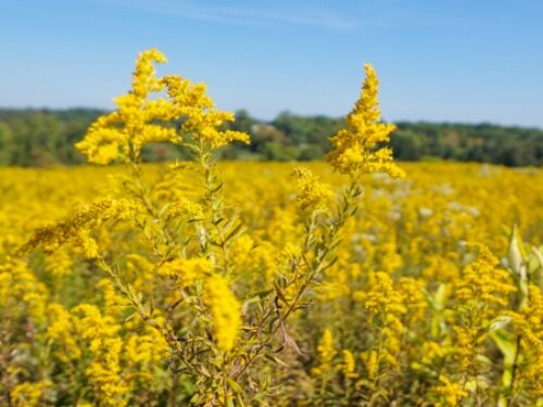
So while many resources would recommend pushing later in the season, we ended up being quite lucky with our ride over Labor Day with excellent weather all around (while still seeing beautiful August wildflowers!). Had we seen a heat wave in the forecast instead, we would've likely woken up earlier and put more miles on the bike before the worst temperatures hit.
The perks of biking when you have more daylight!
No matter what, just keep in mind that the weather is unpredictable many weeks out, so if you're booking in advance, hold your breath and hope you get lucky with a nice stretch of weather for your ride. For us, we only had one brief thunderstorm, and that was two miles from the finish line near DC!
In a way, planning around the weather favors those who are camping and can be flexible on when you depart, because you could potentially just check the upcoming forecast and plan to go during a decent week weather-wise. We committed to our dates well before we knew what the forecast would be, and that is a very big risk.
- If you haven't biked in the rain, even just light rain, we suggest making an effort to do so. If you're biking four, five, six, or more days, you have to get really lucky not to encounter precipitation of some form- even if it is just a light drizzle. Be prepared by having practice, and then put a plan in place for what you may do in various weather conditions (e.g. do you continue to ride, put on rain gear, stop and wait, call in support, etc.).
Finally, it is also worth noting that South Central Pennsylvania is at a higher altitude than the rest of the ride near the starting and ending cities. This can present more localized microclimates and slightly cooler temperatures than elsewhere on the ride. The Laurel Highlands, for example, is often around 5-10 °F cooler than Pittsburgh on any given day. So be sure to check the weather forecast for all of your stops, and not just Pittsburgh and Washington, DC.
Important Highlights to Stop and Enjoy

During our ride from Pittsburgh to Washington DC, we noted many highlights along the ride. The following is not comprehensive, but is a list of the places that we either stopped at to enjoy. These are organized starting from closest to Pittsburgh and ending closest to Washington, DC.
Please note that other highlights that you cannot see immediately from the trail, or aren't within easy walking distance from the trail, are not included. These are only highlights that you'll likely spot easily from your ride and are generally organized in order from west to east.
- Pittsburgh to Connellsville: Point State Park, Color Park, Rivers of Steel Pump House, Kennywood, Carrie Furnace, Edgar Thompson Works, McKeesport Bridges, Boston Train Car, the Red Waterfall, West Newton and Train Car (food stop), the Yough Ness Monster, Cedar Creek County Park, Darr Mine memorial, Sager Mosaics
- Connellsville to Rockwood: Ohiopyle (town and overlooks), Confluence (food stop), Youghiogheny Views
- Rockwood to Cumberland: Pletcher Falls, Salisbury Viaduct, Meyserdale Train Car & Visitors Center, Amish Donuts Jams and Product Stand, Eastern Continental Divide, Big Savage Tunnel, Vistas after Big Savage Tunnel, The Mason-Dixon Line, Frostburg Bike Statues (food stop if willing to walk uphill), GAP-C&O Meeting Point
- Cumberland to Hancock: Locks and Lock Houses, Paw Paw Tunnel, Potomac River Views
- Hancock to Harpers Ferry: Locks and Lock Houses, Potomac River Views, Williamsport (food stop a short ride away), Harpers Ferry
- Harpers Ferry to Washington DC: Locks and Lock Houses, Potomac River Views, Whites Ferry Store & Grill (food stop), Bald Eagles' Nests, Great Falls Park, Mile Marker 0, National Mall (a short ride away)

Although these are some of our favorite highlights of things we saw on our ride, keep your eyes open and if you see something interesting, stop to check it out. This list is just a start!
Camping vs Traditional Accommodations

When planning your accommodations for the GAP and C&O Canal Towpath, you will also have to decide on whether you are going to camp or if you are going to book more traditional accommodations like hotels and home rentals.
To put it bluntly, we personally don't like the idea of camping on a multi-day bike ride, and the previously mentioned suggested routes were built around towns that had proper accommodations to stay in.
While there are many places to camp, possibly even more than towns that have easy-to-access accommodations, it really is about what your tolerance threshold is for carrying extra weight. Even the lightest of camp gear is still quite heavy, and you may also need to carry more of your supplies with you throughout the entire ride. So, like with everything else, be sure to test out your tolerance before tackling the ride, and keep in mind that every extra pound absolutely adds up over 335 or so miles.
For those who do want to camp, there are many campsites along the route, and we even saw bikers setting up and tearing down tents along the trail whenever they simply found a good spot.
For more organized locations, the GAP has many hiker-biker campgrounds as well as public campgrounds (paid) to consider. More information can be found here and also here. The C&O Canal also has some lockhouses that are available for overnight stays as well. These are the old, historic houses found near the locks that often have little to no amenities beyond a roof overhead. Many don't have running water, and guests often have to provide their own linens. As such, these could be options for those who are camping but want a roof overhead in these segments, too. More information can be found here.
For everyone else, there are many accommodation options in select towns along the trails. As noted in our itinerary breakout above, the hardest part of finding accommodations is after the Eastern Continental Divide, particularly in between Cumberland and Hancock. Ignoring this, you will have decent odds of finding a mix of traditional hotels (particularly at your starting/ending cities), bed & breakfasts, or home rentals hosted on the likes of Airbnb.
Before booking any accommodation, it is important to reach out to all hosts and see if they are able to accommodate bikes and, if you are using them, luggage transfer services. While we can say that every place we personally stayed at along the trail was friendly to bikers to varying degrees, and were very helpful with our luggage transfer service, you should still be safe and check before booking. One of our rentals even let us purchase a massive breakfast package that they put in our unit's fridge for us- a nice add-on when the town had no restaurants!
On our own ride, we had a great experience at the following. Please reconfirm amenities prior to booking, as they are accurate as of our ride in 2025 only:
- Connellsville B&B – Connellsville – Centrally located B&B with comfortable rooms, paid laundry facilities, an excellent breakfast, and decent biker amenities in their detached garage.
- Red Brick Roost – Rockwood – A massive house for rent just a few blocks off the bike trail in Rockwood. Perhaps a bit overkill for two (it is quite a large house), but had a great breakfast package was available on pre-order and had free laundry. That said, Rockwood also has very minimal food options for dinner. Bike storage was available in the basement.
- The Shadoe on Greene – Cumberland – Comfortable Townhouse located right off the bike trail and very close to the GAP Mile 0 trailhead. No biker amenities with bike storage inside the unit, but comfortable and a nice stay. Note that the bathroom and kitchen are in the basement, with the bedroom and living room on the main floor, which was a bit of an unconventional layout.
- River Run B&B – Hancock – Centrally located just off the bike trail, oriented for bikers with many amenities, a dedicated bike storage room with ample bike tools, free laundry, and one of the best self-service breakfasts we could ask for.
- Seven Magnolias – Harpers Ferry – A stunning house converted to a B&B in Harpers Ferry. Located at the top of a modestly steep hill in town, across the bridge from the trail. Few biker amenities with outside storage in a secluded garden (take a lock), and we unfortunately departed before breakfast hours, but it was an excellent host and stay all around.
- AC Hotel Washington – Washington DC – Comfortable hotel in the heart of DC, a couple of miles from the National Mall and C&O Mile 0 Marker. Let us keep our bikes in the room.
As far as the above are concerned, we'd absolutely stay at every place mentioned above again, despite some limitations here or there. That said, River Run B&B in Hancock could be considered the gold standard amongst those that we stayed at for bikers, and you'd be remiss not to book there if staying overnight in Hancock.
For those who are biking from Washington DC to Pittsburgh, or need a hotel in the city before departing your ride eastward, we cannot recommend The Traveler's Rest Hotel highly enough, too. This bike-friendly hotel is located right off the GAP, just a mile or so outside of Point State Park and has many bike-friendly amenities, comfortable rooms, and a wonderful staff. While we did not stay there overnight for our ride, we have been guests and are big fans.
Luggage Transfer Services

As mentioned in our discussion of accommodations, taking all of your clothes, toiletries, and other gear on your bikes can really add a lot of weight in a hurry. Every extra pound of weight will have you go that much slower and make for that much less enjoyable a trip.
Can you get by on the essentials? As it turned out, roughly every other B&B we stayed at had a washer and dryer, so we could've packed relatively light if needed. But throw on the fact that we had to take a computer for work reasons and a full pack of toiletries (due to an allergy and not being able to trust the hotel-provided products at times), we had more weight than what others may require.
Considering we had no experience biking with massive packs, we really didn't want to push it too hard for this ride and opted for a courier service.
Thankfully, many businesses exist to support the ride on the GAP and C&O, and this includes luggage transfer services that will pick up and drop off your luggage at each accommodation during your stay. While these are not cheap, a splurge in spending here can go a long way to a much more enjoyable trip.
For our own ride, we hired Sunshine Luggage Shuttle and had a great experience. Our bags were picked up and dropped off all while we were biking, and perhaps the most ironic part about all of this is we never saw our courier once, either- it was all handled behind the scenes thanks to our helpful hosts and a friendly neighbor who held our bags for us at the start!
As noted above, be sure to confirm that your overnight stays can accommodate luggage transfer services, as some may have to be available to hand your luggage over at a predetermined time (or, at a minimum, a process in place like leaving your bags at a set area). Thankfully, almost all of our accommodations had worked with Sunshine Luggage Shuttle before, and it was quite a breeze!
- Exclusive Discount: Mention Discover the Burgh when inquiring about luggage transfer with Sunshine Luggage Shuttle to receive $20 off a 4 day GAP trip or $30 off an 8 day GAP and C&O trip!
Packing List for the GAP

Now that we've talked about the logistics of moving your gear, let's talk about what all you need to take with you in a packing list!
Ultimately, this one can vary a lot as every traveler is different. Will you be staying somewhere where you can do laundry sometime during your journey? Do you plan on re-wearing street clothes at the end of the day? What about planning for a nice meal out at the end of your trip?
For this packing list, we don't really want to talk too much about the traditional clothing that would go in your luggage- we packed about four days' worth of non-bike street clothes and did laundry a couple of times. Since we utilized a luggage transfer service, we had plenty of room for one week of traditional clothing in our suitcase.
For this one, we want to make recommendations of all of the bike-specific items you may need (and others you may forget about), both in bike bags for during the ride and in your suitcase to access at night and swap out as needed.
Items you may want to pack in your bike bags are as follows (* denotes items we didn't use, but we would still pack anyway for emergencies):
- Wallet/ID/keys
- Medications
- Camera and accessories
- Power bank
- Charging cord
- Bug spray
- Sunglasses
- Antiseptics*
- Bandaids / Other First Aid*
- Luggage locks
- Head torch
- Bike repair kit
- Bike patch kit*
- Replacement tubes (bike-specific sizes)
- Road snacks
- Water bottles
- Water filter (for emergencies on the C&O Canal as most pump stations aren't potable)*
- Duct tape*
- Zip ties
- Bike cable locks
- Bike valve adapters (in our limited sampling, we encountered more Schrader pump types and fewer ones compatible with our Presta valves)
Items you may want to pack in your luggage to swap out in your bike bag day-to-day are as follows:
- Extra pair of quick-dry, padded bike pants (washing a pair to have fresh bike pants every day helps!)
- Extra quick-dry bike shirt
- Extra pair of bike gloves*
- Waterproof jacket
- Light pair of pants for cooler mornings
- Jacket for cooler mornings*
- Umbrella*
- An extra pair of shoes for walking around
- An EZ-Pass toll transponder if driving back home
- Chamois butter
- Extra road snacks
- MRE food kits (we packed one each just in case)*
One thing that is worth remembering is that once you leave your bag for the day (if using a luggage transfer service, that is), you won't be able to access it until you reach your next destination.
So be sure to swap out what you need day-to-day to account for things like biking distances (snacks), the weather forecast (jacket/pants), tunnel segments (head torches), and more. Although we biked at the end of August and early September which should normally be fairly warm, the forecast included some rather chilly mornings below 50°F, so we made sure to have a warm jacket and long pants that we could take off once we warmed up as the day went on- so planning on having some extra room in your bike bags may also help, too.
- Extra Tips: There are long segments of the trail without cell signal, so be sure to have everything downloaded to your phone that you may need. This includes music playlists, which we thought were extra helpful to get us through the last few miles every day when we hit a wall.
- Our bikes also didn't have a bell (we forgot to put it on before we left), so we would recommend having one of those or even a whistle to try and alert anyone you're biking with about any issues if you're not sticking close together. I'm not going to say that Angie would blast a mile ahead of me at times, but I'm not going to say she didn't, either.
Recording the Trip – Camera Setup

Now, if you're going on this epic ride, it is worth considering how you are going to document it in photos and videos. A phone, naturally, is a bit obligatory, but it may be hard to pull out and use mid-ride. We wanted a solution for being able to document while in motion, so we went a bit further for capturing photos and videos.
On my bike, I mounted my phone and an Insta360 X5 camera, which I thought made for a great duo. The Insta360 is a 360-degree camera with both front and back lenses, and synced up to my phone to use as a remote control.
Although I did feel like the photos from the Insta360 were too wide-angle for the best shots of the trail (I took my phone out of the mount for most shots that didn't have a subject in the immediate foreground), the Insta360 was excellent for video. All I had to do was open the app on my phone, click to video mode, select the lens, hit record, and let it go. (It also had an easy-to-use interface on the camera, too- I just preferred to use my phone as a remote control.)
- Check out a video with footage from the Insta360 here. Clips that show riding on the trail are from the Insta360, while traditional panning videos are from our cell phone.
Could we have had similar shots with our mounted phone? Perhaps, but it would likely also require changing the mounting angle, which would've made it a bit harder to use while in motion. For images, we mostly stopped our bikes, got off, took the phones off the mount, and composed the photos with angles we wanted- not necessarily from the fixed view from our bike.
With this setup, we recommend riding with the camera a bit before going out to get your settings dialed in. We turned on linear mode to offset the fisheye and changed some of the HDR and resolution settings for the best output (and edited on the Insta360 proprietary software as the camera exports in nontraditional formats). If you want to do a set-it-and-forget-it approach, you may want to try some of the interval shooting modes, too. I skipped these in favor of recording scenes I was sure I wanted to capture.
It takes a bit getting used to, but for riding videos, the Insta360 was epic. For everything else, primarily photos and off-bike videos, we relied on our phones both for shots in-hand and via shots taken on a small tripod we packed in our bike bags.

Finally, you may want to consider taking a larger power bank in your bag and a long cable to plug into devices as you ride. The Insta360 X5, while a solid camera, doesn't have a terribly long battery life (I estimated about 90 minutes). So, coupled with a power bank with fast charging capabilities, our devices always stayed powered for the full ride. I just zip-tied the cord to the frame of my bike to prevent it from bouncing around.
What we took:
- Insta360 X5
- Insta360 bike kit with mount and selfie stick
- Google Pixel 9 Pro XL
- Cell phone mount
- Cell phone tripod (for trail shots of both of us)
- 20,000 mAh Power bank (we found ours was good for about 2-3 full device charges)
- Long power cords
There were two items we did not take on our ride, and those were our Sony a7RIII camera and DJI Mini 4 drone. While I love these devices, both are fairly bulky and would've been used sparingly relative to overall ride time. As much as I wanted drone photos along the ride, it was still extra weight at the end of the day.
Did I want to take them for their better quality images? Absolutely. Did I want to lug the weight? Not in the slightest. As such, upgrading to the lightweight Insta360 X5 and using my decently powered camera on my phone was good enough for me.
How to Get Home – Private Transfer, Train, or Rental

One thing that is likely certain with this ride is that you're probably not turning around and doing it again to come home. So, how do you make it back to Pittsburgh or Washington DC?
Really, there are three major options to consider- booking a private transfer with a dedicated service, taking the Amtrak train, or renting a vehicle. Each has its own pros and cons.
Private transfer services can pick you up from your local hotel, load your bikes, and drive you back to where you started. They are the most convenient and do not require much effort on your part, but come at a fairly high price point.
Amtrak is among the cheapest options, and generally takes about eight hours in either direction. The Pittsburgh to Washington DC route typically departs at around 5:30 am and gets in around 1 pm, while the Washington DC to Pittsburgh route typically departs around 4 pm and gets in closer to midnight. (As always, reconfirm as train times do change.)
Taking the train is super easy, and they have options to buy bike storage add-ons if you snag your tickets early. But those who don't get the limited bike slots will have to box up their bikes, which can be a hassle, and then of course, you have to figure out the logistics of getting to/from the train stations to your final destination. For us, we still would've had to get someone with a large vehicle to pick us up since we biked from our home.
- If you're coming in from out of town to bike from Pittsburgh to Washington DC, we heard from many on the trail that they parked their car at the Grant Street Transportation Center garage, right next to the Amtrak station, and stayed at a hotel nearby. This would make for an easy in and out of Pittsburgh when taking the train back from Washington DC.
The final option is renting a car to load up your bikes and drive home. Here, you want to make sure the vehicle is large enough for your bikes, which likely means a van or a large SUV. We had originally rented a van with Enterprise, only to be told the night before that the vehicle (and no other comparable SUV) were apparently available in central Washington DC. We found an AVIS around the corner from our hotel and got a last-minute Suburban, which was rather easy to fit our bikes in for the ride home.
The benefit of getting this car, despite risks like the one we experienced above, was that we could leave whenever we wanted and got home at a much more reasonable time- all for just a little bit more than paying for Amtrak.
Whatever you pick is up to you, but these are the three most popular options.
FAQ About Biking from Pittsburgh to Washington DC

After completing our ride, we had numerous questions come up about the trip. We wanted to end this one with a few final points that may not have made their way into the above discussions.
What kind of bikes do you have? We ride on Trek FX3 hybrids and had them serviced before our ride (side note- we love these bikes). We think most hybrid and gravel bikes are probably fine for this ride, insofar as your tires are at least 30mm or larger. Our 32mm tires were probably the smallest we'd ever want to attempt this ride on, particularly due to the rugged nature of the C&O, more so than the GAP.
Can you use e-bikes? We saw people riding with e-bikes for some stretches; however, we have to admit that we would be concerned about how long the battery lasts and recharging points for a multi-day ride. We would recommend being very careful to confirm charging logistics at each overnight stay if wanting to use e-bikes, as otherwise you may end up pedaling even more weight. That said, we do admit we saw more riders on e-bikes on the GAP than the C&O, for what it is worth.
Is it hard to bike from Pittsburgh to DC? From our perspective, it isn't really that difficult- it is more of an endurance ride than anything. That said, biking east to Washington DC is a fair bit easier than biking west to Pittsburgh due to the topography, particularly around the Eastern Continental Divide. If you can bike 40 miles somewhat regularly without issue, you probably are okay on this ride, insofar as you think you can bike multiple days in a row at that level.

Is the C&O really as bad as some people say? It isn't a great trail, but it isn't a bad trail, either. Some segments feel like you're biking on a rural gravel backroad with grass growing in between tire lines. Others have varying conditions like large gravel chunks, potholes, debris, sand fill, etc. It isn't necessarily a hard ride, but it is definitely one where you need to be much more focused on what is coming up, which is taxing mentally just as it is physically. If you're riding with others, stick close so that whoever is in front can signal things to watch out for, as you'll be doing that a lot. We can see how this one would be a whole lot harder after rain when it is muddy, though.
How did you train for this ride? Admittedly, we didn't. The year we rode to DC had really bad weather all summer, and we didn't get a chance to do any of the long rides we usually like to do every year. We did bike PedalPGH's 40 miler a week before, but otherwise mostly just rode 10-20 mile rides here or there. We really do believe that if you are comfortable with 40-mile rides a few times a year with regular riding in between, you can do this one, even a 66.5-mile day like we had.
How long did it take you to get comfortable riding long distances? Although we've been seriously riding for six years, we probably got in good biking shape in about 2-3 years, if we're honest. The first time we rode bikes in Pittsburgh, eight miles was tough. But then eight miles turned into 10, which turned into 15, which turned into 25, which turned into 40, which turned into 50. If you're willing to push yourself more than last time, do it. Then do it again. Even if it is just an extra mile, make that extra push. Repeat until you hit 40 or 50 miles fairly comfortably (read: not hurting yourself- tired is absolutely ok), and you should be good to go!

Do you need cash? We recommend having a small amount of cash, at least $20-$40 per person, or just a bit more if there are any paid shuttle detours you may need to take (we took $100). Most everywhere we visited took cards, but some small stands here or there were cash only. We met many riders who didn't realize that the shuttle detour required a cash payment, for example. So take some cash with you just to be safe- you can always use it later if you have some money leftover.
Is there anything you wish you had done differently? Our six-day ride was great, so much so that we thought it was a perfect itinerary for us. We probably could've managed in five, but it would've been a lot, and we wanted to enjoy our experience without overdoing it. If we pushed harder, we probably would've considered an extra rest day in Ohiopyle or Harpers Ferry to actually see things as both of these towns have a lot that we had to skip (we've been to each before). The only real regret we had was not taking more snacks on the Cumberland to Hancock day when we couldn't stop for lunch, and perhaps not having more playlists downloaded for when we didn't have a cell signal.
Are you going to go back and bike the segment that was closed that you had to shuttle around? Unless we bike the GAP in its entirety again, absolutely not. If it were a 60-mile stretch, we may have a different opinion, but roughly eight miles we can live with not knowing what we missed.
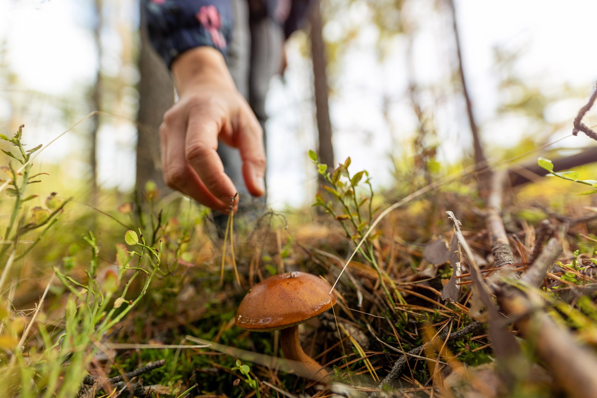
What kind of snacks did you take? We had a mix of Clif Bars, energy gummies, energy gels, dried fruit, and electrolyte packets to add to our water (pro tip- keep one bottle for regular water and one only for electrolyte packets). Angie has a tree nut allergy, so we had to skip anything with nuts in it, which sadly would've helped a lot. We personally enjoyed the energy gummies and gels that had caffeine and electrolytes added- you really can feel the boost after those. We were also fortunate to bike at the start of paw paw season and found plenty of fruit on the ground on the C&O trail as well.

Can I do this solo? Can you? Theoretically, sure. Should you? That would depend on your skills, tolerance for risk, and available support network. There are a lot of stretches without cell signal, and honestly, we went half a day or more on the C&O without another person during busy season. We have read many reports of solo riders being fine, but you really need to be careful, have a support network, and have more plans on what to do in the case of an emergency. Personally, we couldn't imagine doing this ride alone, but also, we are still shocked we did it just the two of us.
How many dogs did you see? 62. Yes, we counted. No, we didn't pet them all. We were pretty bummed it wasn't higher. A third of them were on day one near Pittsburgh, though. We also saw one trail cat.
Can I take my dog? Cat? Child? For all of these, the answer is yes, if you're okay with hauling the extra weight. Every extra pound adds up on the long days. From there, for animals, you'd need to check if campgrounds and/or individual accommodations allow them. We'd love to hear about stories of people taking a dog in a sidecar the whole way, but it also feels a bit impractical considering the extra weight. That said, we did meet riders with children in an attached trailer and managed just fine insofar as we could tell.

What was the best day and worst day? Our favorite day was biking from Rockwood to Cumberland on the GAP for all the highlights like the Eastern Continental Divide, Mason-Dixon Line, Big Savage Tunnel, etc. We could argue that the day leaving Pittsburgh was up there too in terms of variety of what you can see, but we bike that one a lot, so that scenery wasn't exactly new for us (if you've never been to Pittsburgh, though, it is quite nice). Our worst day was probably biking from Hancock to Harpers Ferry, as we hit a mental block on the ride in the last few miles that was challenging, but the Cumberland to Hancock day just had a lot of the same scenery and no real chances to stop in any towns for food.
Did you lose weight on the ride? Surprisingly, no. We actually didn't sweat that much due to having great weather, and between our somewhat poor diet while riding (restaurants along the route didn't really have what we'd call healthy menus), ample water consumption, and celebratory beer, we more or less came back neutral. That said, our legs did feel much more defined by the end, so maybe we picked up some muscle and lost some fat- but it is hard to say.

Should I plan for rain and/or a flat tire? Absolutely. We think it is inevitable that you will see rain and have at least one flat tire on your ride, if not a few. Many people don't experience either, we will admit, but it's better to plan for the assumption that you will and go from there. Those who are camping and heading out on a whim based on good weather forecasts may get lucky in that respect (noting the weather patterns on the ride vary considerably), but you can't predict flat tires in the slightest. We had two flat tires, and neither was from when we were riding!
What detours did you take? The biggest detour we had on our ride was that we needed to hop onto a shuttle between Markleton and Rockwood due to a landslide in 2025. A couple of other detours we took was hopping on the Western Maryland Rail Trail outside of Hancock to ride on the objectively much nicer trail conditions for a handful of miles (it runs parallel to the C&O, but chart your entry and exits to avoid getting on at the wrong segment), as well as the Capital Crescent Trail for the last few miles into Washington DC towards Mile Marker 0. We highly recommend looking into these two options for a better ride.
Where on your body hurt the most at the end of each day? By the end of day one, definitely the legs. But surprisingly, the morning of day two, we were ready to go again, and our legs felt “activated” for most of the ride after the first few miles. They got tired, sure, but never really felt full-on pain like we expected (note we do ride 10-20 miles somewhat regularly, so that may just be our conditioning). The biggest pain in the butt was… the butt. Many hours on a bike seat makes for a really sore, chafed bottom. Yes, you want Chamois Butt'r or equivalent. Yes, start using it on day one. Yes, all the time. We're serious.

How early do I need to book? Assuming you're not camping and going on a whim, friends of ours who work in the trail industry said there are generally three kinds of booking windows. The first type of booking is in the fall for the following season, where the trip is built around when you can secure the bike storage add-on for Amtrak (so book that on an available date first, work backward from there). The second is those who book a month or two out in the same season, where you are looking to secure ideal hotels/B&Bs for your route before they book up (this was what we did). The third tier would be for those who book last minute, within 7-10 days, who book primarily based on the weather. This is the biggest risk because you may need to be more flexible on where you stay based on availability (we, personally, recommend this one better for those who can camp, but we see the logic either way).
Would you do it again? The GAP- yes. The C&O- maybe not. We love a good long-distance ride and are incredibly glad we did this one, but we don't necessarily need to do it again. Part of this is because we enjoy new and changing scenery while riding, and the stretches in the forest, particularly on the poorer segments of the C&O, are not ones we want to see again anytime soon (as pretty as it was). We would consider biking to Cumberland in two days along the GAP at some point in the future, though- the scenery changed enough for us to keep things interesting.
Where are you going to bike next? In the Pittsburgh area, we either take our normal bike ride on the North Shore River Trail and around and up through Riverview Park, or our favorite 50-mile ride on the Ghost Town Trail, which we always try to do once a year. For a new, long ride, we're eyeing the Danube Trail in Eastern Europe, but you'll have to follow our travel blog Living the Dream to see more on that if we ever do it!
Do you have any other advice for those looking to ride from Pittsburgh to DC? Plan well, book it, and go! You'll always regret the things you didn't do over the things you did. But, perhaps, also book a massage for when it is all over to treat yourself.
Do you have any questions about biking the GAP and C&O Trail? Or do you have any insights to share from your own ride we missed? Comment to share!
Pittsburgh Discounts and Promotions
In the mood for a sale? Or perhaps you simply want to try out something new? Check out our latest Pittsburgh promotions below!

🍎 $40 Off your first box from Harvie

🖼️ 15% Off Carnegie Museums membership — code MEMDisctheBurgh15

🏨 Up to 15% Off at The Oaklander
🌿 20% Off foraging classes at Wyld Forest
🧳 $20 off 4-day luggage transfer on the GAP and $30 off 8-day transfer on the GAP & C&O with Sunshine Luggage Shuttle — mention Discover the Burgh when inquiring.
🏛️ Looking to host a coupon? Get in touch at our contact form to learn more!
Are you a local business that would like featured? Click here!

Great blog with lots of useful tips and insights. I’m riding this with some buddies starting oct 11. hope the weather is good!
Fingers crossed for good weather. Thanks for the kind words!
Lots of great info here! I did the ride mostly solo/unsupported last year and the only info I would add is:
• Bring different kinds of padded bike shorts/underwear to avoid repeated chafing, even with chamois cream.
• Carry a small first aid kit with gauze pads, butterfly bandages, first aid tape, tweezers, gloves, etc. Mine came in handy for helping an injured rider.
• The trail community is very friendly! Favorite stops were Connellsville Canteen (also a WW2 museum) and many microbreweries.
Excellent tips. I will update our article to mention those! Sad we missed the Connellsville Canteen but thankful we can drive there and will visit soon.