Published by Jeremy. Last Updated on November 22, 2023.
Disclaimer: Our site uses demographic data, email opt-ins, display advertising, and affiliate links. Please check out our Terms and Conditions. Pricing, operating hours, or menus may have changed since our initial visit and may not be reflected in subsequent updates. Please confirm these directly with any business or attraction prior to visiting.
When it comes to hiking in the Laurel Highlands, there are a number of parks to choose from. In fact, this region is home to ten state parks and state forests that cover roughly 120,000 acres- and that is not even counting the smaller parks, runs, and green spaces as well.
As such, when we say that Laurel Hill State Park may be our favorite of them all, we say that with some gravity behind it.
This park is simply stunning!
What You Can See at Laurel Hill State Park

Laurel Hill State Park has a wealth of things to see, and even though we've visited a few times, we still have many parts left to explore ourselves.
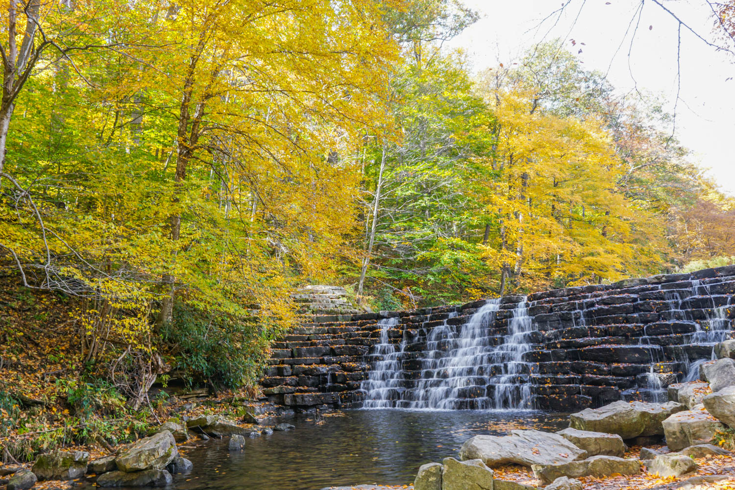
One of the biggest highlights of the park for many guests is the Jones Mill Run Dam. This dam was constructed in 1935 by the CCC and was built in such a way that the water runs down it in a beautiful cascade waterfall- a real must-see that can be accessed with a shorter hike!

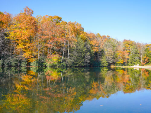
Next up is Laurel Hill Lake- a focal point within the park. This lake was the result of a larger dam being installed by the CCC and has trails running along both sides. Those looking for a more leisurely stroll will want to stick to the western side of the lake as a more accessible promenade can be found as well as a beach (note that the beach does not allow pets)!
A final trail of note to check out is the Hemlock Trail, accessible via the boat launch at the northern end of Laurel Hill Lake. This ~1.5 mile trail runs between some of the oldest hemlock trees in the park and offers something just a bit different from the other trails mentioned so far.
Finally, as the main road that passes through the park exits on the opposing side (it is not a loop), you'll do well to simply drive the length of the park to get some great views from your car- especially if you visit during peak fall colors as we did!
Hiking at Laurel Hill State Park

The trails at Laurel Hill State Park run the gamut of difficulty levels with most covering a distance between 0.5 and 2.75 miles. As such, during a single visit, you should plan to hit a few trails to see a good cross-section of the park (or even make a day of it with another state park nearby).
For those who want to visit Jones Mill Run Dam, you can take the fairly easy walk on the Pumphouse Trail roughly half the length (a sign is visible where you should turn left to see the dam). From there, you could either do a large loop of ~3 miles on the rest of the Pumphouse Trail and connect to the Martz and Water Line Trails or take the shorter loop back on the Tram Road Trail and cut across at the Shay Connector to return to the Pumphouse Trail (this will be the first trail crossing on your left after about a half-mile or so).

It is worth noting that the Tram Road connector has a solid 50 foot stretch with a large concentration of smaller rocks that may require some delicate maneuvering. But once you pass through this section, hiking is a breeze.
For those who want an easier walk, the 1.25 mile Copper Kettle Trail is worth a stop as it passes down the western edge of Laurel Hill Lake, is relatively accessible, and accesses both the beach and the dam on the southern end.
When visiting the park, many of the most popular trails are accessible from the main road that cuts through the park. Signs for most of the trails are visible from the road, but some are more prominent than others (it took us driving along the road a few times to see the Hemlock Trail sign, for example).
The park map features GPS coordinates for some of the must-see spots in the park and could be a good option to put in your GPS to get you close to the trailheads starting out. Otherwise, you'll likely want to have a good idea of the rough locations of the trailheads prior to visiting, or pick up a map at the park office when you arrive if one is available (we also saw maps available at some trailheads).
Overall, Laurel Hill State Park has a lot to see, but the highlights are also split up over several, somewhat shorter trails. As such, when you visit this one plan on hiking two or three trails to really get a nice cross-section of what it is all about!
Laurel Hill State Park is located at 1454 Laurel Hill Park Road in Somerset, PA- just a short drive away from Seven Springs.
On your way back from Laurel Hill State Park, be sure to stop and grab a meal at Out of the Fire Cafe in Donegal!


Laurel Hill State Park is beautiful. In addition to the hikes, it is a great place for a picnic lunch by the beach at the lake. Tables are placed in trees above the lake.
There is also an observation tower that is part of the park and requires a short hike (1/2 mile +/-) from the parking lot to the tower. The coordinates are listed on the park map.
I discovered Laurel Hill during the pandemic. Hemlock Trail was amazing. Thank you for this article, and I need to explore more of that park.